Discovery of new active faults beneath Florence: a fresh perspective on the geology of the Florence Basin and Northern Apennines
A recent multidisciplinary study has revealed the existence of active faults beneath the Florence plain, a sector of the northern Apennines that had so far received little attention. The research, carried out by the Institute of Geosciences and Earth Resources (IGG-CNR) and the Seismic Sector of the Tuscany Region, combined geomorphological surveys, LiDAR data, electrical tomography, and high-resolution reflection seismics. This integrated approach allowed the team to reconstruct in detail the geometry and architecture of the buried fault systems that shape the Florentine basin.
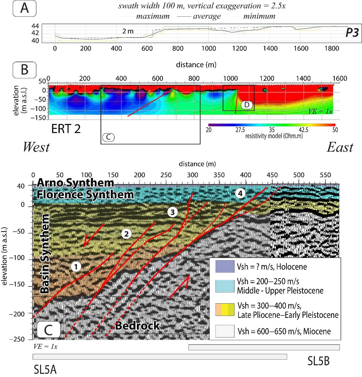
For the first time, active structures crossing directly beneath the urban area have been identified and characterized. The NE–SW trending Peretola, Scandicci, and Maiano faults deform Late Pleistocene and Holocene sediments, while the Fiesole fault, linked to the northwestern margin of the basin, appears to show more limited activity. Among them, the Scandicci fault stands out as the main structure, extending for about 9 km in the subsurface, with evidence of recent movement and uplift rates comparable to those of other active faults in the northern Apennines.
The study also highlighted that deformation is not confined to a single surface but distributed across multiple parallel planes, forming fault zones up to 200 meters thick. This complexity reveals a highly articulated tectonic organization that enriches our understanding of the dynamics of the Florence–Prato–Pistoia basin.
A particularly significant aspect concerns the NE–SW orientation of these faults, which suggests a stress field more complex than previously thought. The active transverse structures may reflect processes of extrusion or block rotation, opening new perspectives on the recent evolution of the northern Apennines.
These new findings represent a substantial step forward in the understanding of the region’s tectonic evolution and add an entirely new chapter to the geological framework of Florence, contributing both to the history of the city and its surrounding territory. They also provide a starting point for future studies aimed at revising the geodynamic and paleoseismological models of the region.
Reference
Piccardi L., D’Alessandro A., Vittori E., D’Intinosante V., Baglione M., 2025. An Integrated Remote Sensing and Near-Surface Geophysical Approach to Detect and Characterize Active and Capable Faults in the Urban Area of Florence (Italy). Remote Sens. 2025, 17, 2644. https://doi.org/10.3390/rs17152644.
For more info: Luigi Piccardi (luigi.piccardi@cnr.it), Massimo Baglione (massimo.baglione@regione.toscana.it).