Laboratory of Experimental and Numerical Hydrogeology
- Home
- Instruments and Personnel
- Methods and Applications
- Project and Scientific Interests
- Pubblications

The Laboratory of Experimental and Numerical Hydrogeology carries out activities mainly aimed at defining the physical aspects that affect groundwater flow: water quantities, in terms of infiltration, transit and outflow in and from the aquifer; hydrodynamic parameters and conditions; hydraulic parameters; groundwater and surface water interactions; flow paths geometry; hydrogeological boundaries. More in general, laboratory methodologies and instruments are also applied for studying the water bodies (superficial and underground) evolution in relation to global changes.
The work flow is developed by two main typologies of activities: 1) production of experimental data on field; 2) numerical hydrogeological modelling of groundwater flow and conservative transport.
The laboratory is in close cooperation with other IGG laboratories (e.g. chemical, isotopic, GIS laboratories) and it fosters several projects mainly carried out by the IGG Research Lines “Aquifer Systems: Sustainability and Global Changes” and “Geothermal Resources”.
INSTRUMENTS AND PERSONNEL
The laboratory equipment allow the quantification and sampling of rainfall, the punctual measurements of flowrates and water levels, the continuous monitoring of temperature-electrical conductivity-piezometric level-flowrate, the performance of pumping tests-slug tests-tracer tests, the execution of temperature and electrical conductivity log within wells/piezometers, the sampling at defined intervals of depth. Software for data acquisition and numerical hydrogeological modelling are moreover used.
Instruments:
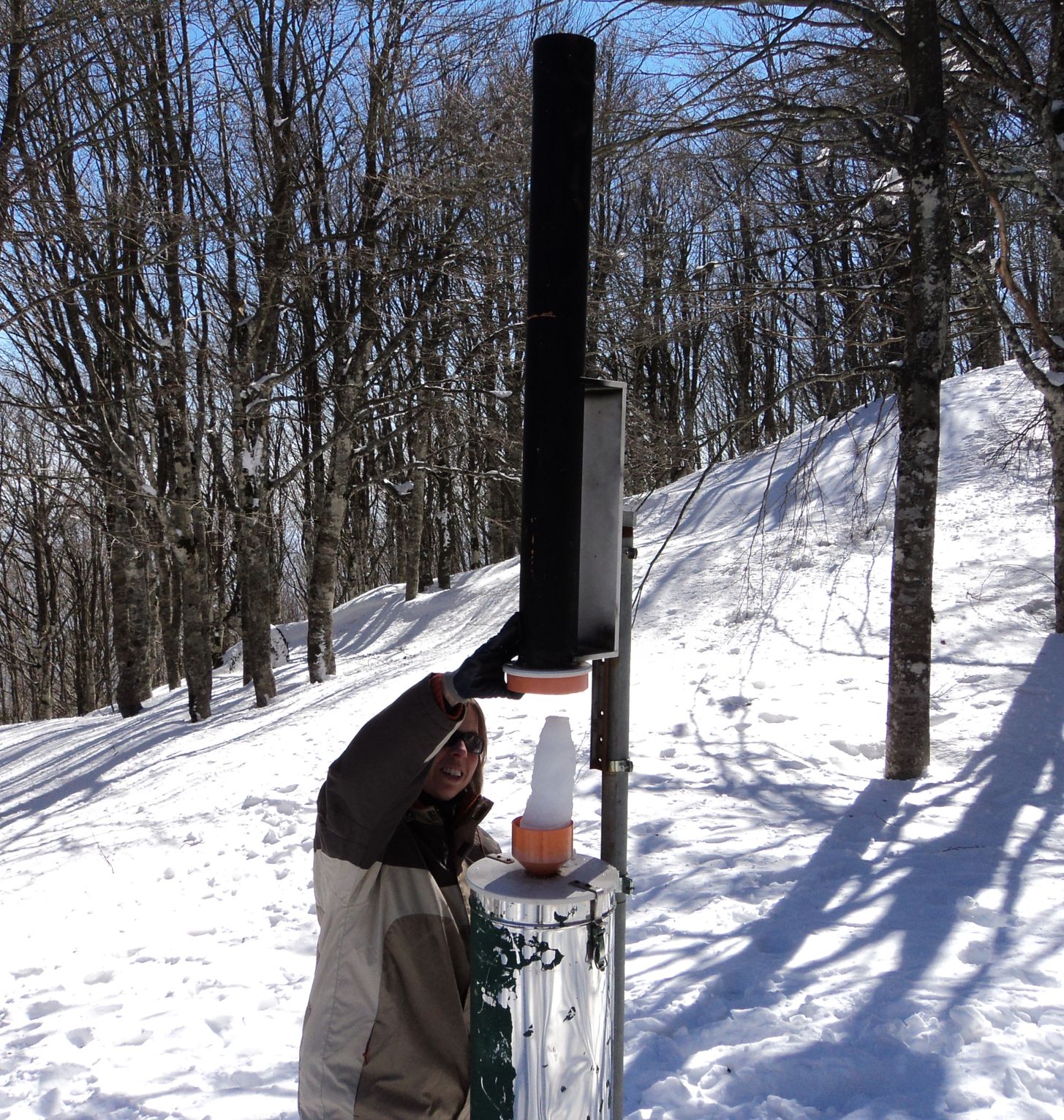
- rain/snow gages
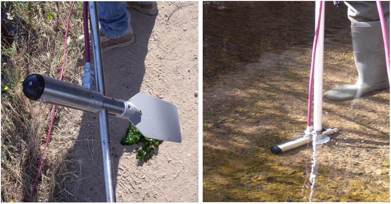
- mobile acoustic flow measurement AquaProfiler (SEBA-Hydrometrie)
- phreatimeters and thermo-phreatimeters
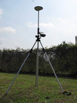
- differential GPS (Leica Geosystems)
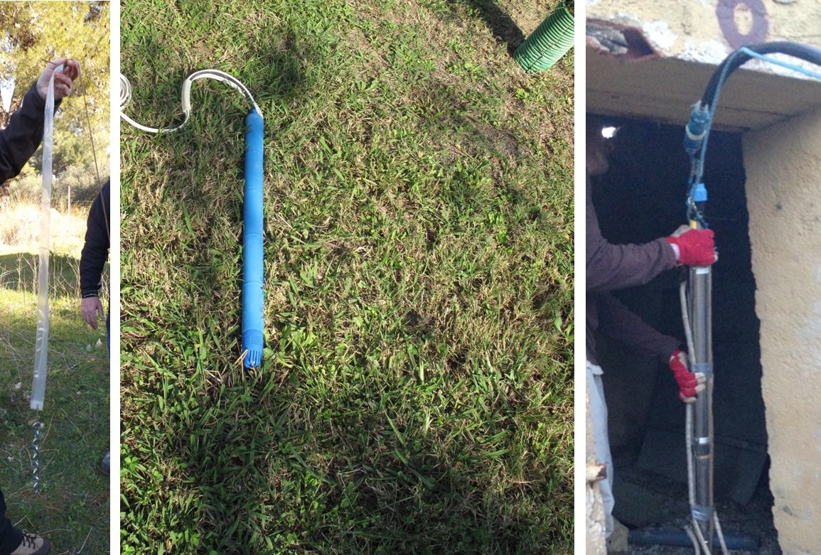
- multi-parameter probes CTD-Diver, CeraDiver e TermoBaroDiver (Schlumberger)
- samplers for defined depths (HydraSleeve)
- pumps of high and low flow
- weirs
- equipment for tracer tests
- equipment for sampling and physical-chemical log within well/piezometer up to 500 m of depth
software for hydrogeological modelling:
- Visual MODFLOW Premium
- FeFlow
- Groundwater Vistas Advanced
- Groundwater Modeling System-GMS
Staff
Marco Doveri (Researcher – Laboratory Head)
Matia Menichini (Researcher)
Sandra Trifirò (Technician)
Contacts
+39 050 621 2611 (Marco Doveri)
+39 050 621 2327 (Matia Menichini/Sandra Trifirò)
E-mail:
marco.doveri@igg.cnr.it
matia.menichini@igg.cnr.it
sandra.trifiro@igg.cnr.it
The parameters characterization and the knowledge of the physical processes are accomplished by applying several methodologies, often integrated among themselves.
Effective rainfall - By means of rain/snow gauges, the monthly rainfall are collected in order to achieve the amount and the isotope signature. The installation of thermometric and barometric sensors is also provided and the registered data are elaborated for defining the evapotranspiration as well as the effective rainfall and its isotope signature, which is used as tracer for understanding physical aspects of groundwater flow (geometry, mixings, residence time, etc.).
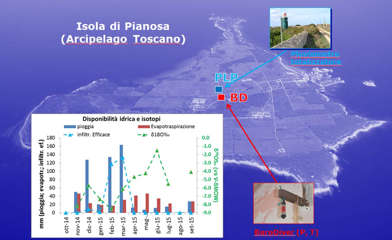
Water flowrates - Water flowrates are defined by mobile acoustic flow measurement, weirs with automatic system of water level registration, and the dilution method. Along streams the measurements are performed on sequential sections to verify the interaction between groundwater and streamwater.

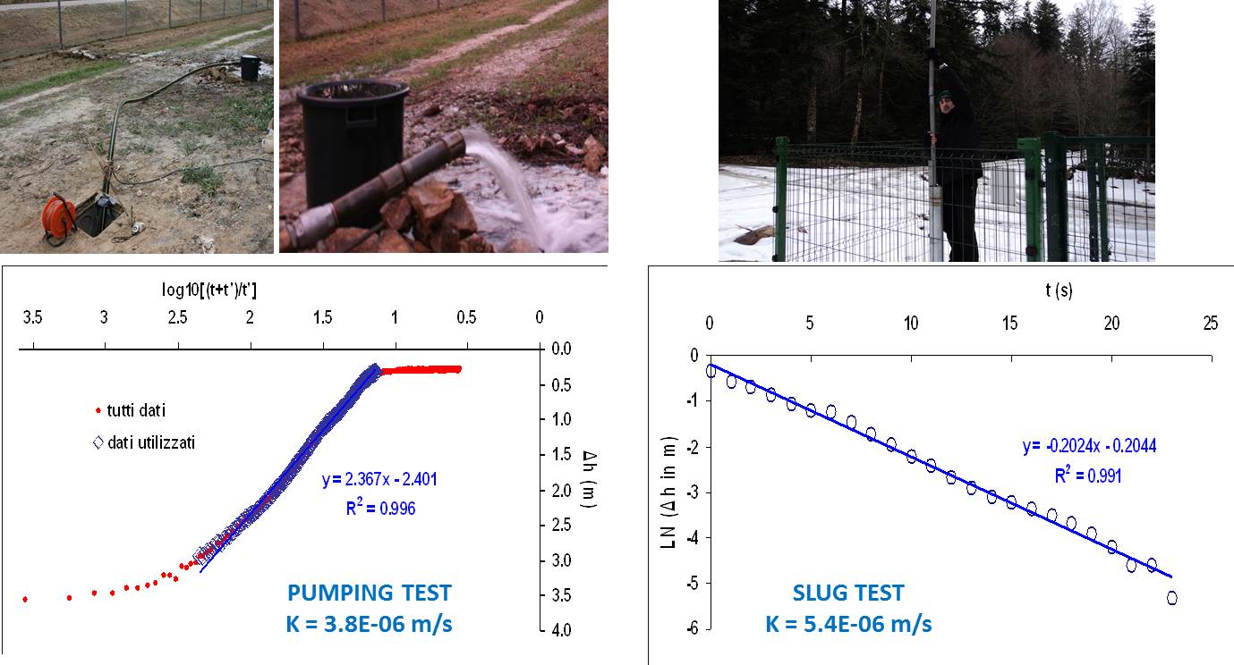
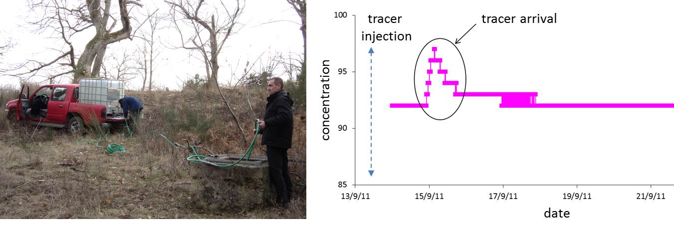
Hydrodynamics and hydraulic features of the aquifer - Hydrodynamic aspects are studied by elaborating piezometric surfaces (based on field measurements repeated in different regime conditions) as well as analysing the time series of physical-chemical parameters (temperature, electrical conductivity, water level, flowrate) monitored on a selection of water points. The use of a differential GPS guarantees a precise definition of the reference plane on which calculate piezometric levels. Information on the hydrodynamic behaviour are moreover achieved by the periodic analyses of water isotope signatures on selected points. Accordingly to the context under study, tracer tests area also done with the aim to achieve information about the water velocity and the hydro-dispersive features of the aquifer. Hydraulic parameters are defined performing pumping tests and/or slug tests.
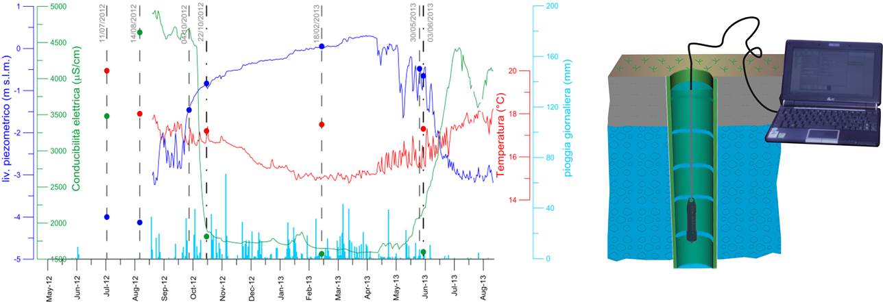
Geometric features of groundwater flow - Different approaches are used to achieve information about the extension and domain of groundwater flow paths, as well as the spatial distribution of the same. One of this is based on the comparison between the isotope signatures of the water points of interest and those of the infiltration water. The latter are achieved by means of rain/snow gauges and, mainly, by sampling specific springs selected accordingly the morphological and hydrogeological contexts. The feeding areas accomplished through this approach are then verified by performing water and isotopic balances. Geometric information are also achieved: by analyzing the time series of data registered on water level, flowrate, temperature and electrical conductivity for wells and/or springs; from the study of temperature and electrical conductivity values achieved by vertical logs within wells/piezometers; from results of samples collected at defined depths within wells/piezometers; by hydraulic tests.
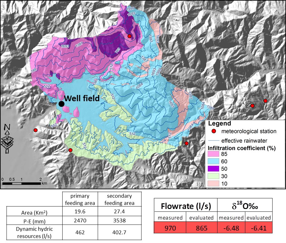
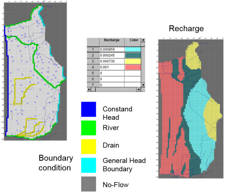
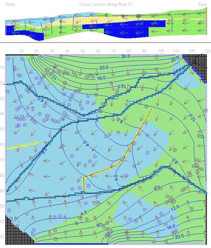
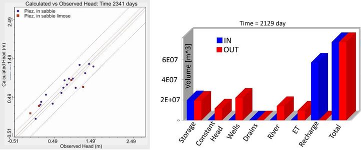
Numerical approach - Groundwater flow and transport modeling is based on the wide IGG experience in developing detailed conceptual model of aquifer systems and on the huge quantity of data produced both for physical and geochemical aspects of water resources. The work consists of the implementation, calibration and simulation of physical-based models by using the MODFLOW or FEFLOW codes. Groundwater predictions are simulated under climate conditions defined by climate modeling performed by external research groups (e.g. LaMMA group), which cooperate with the laboratory. Also, an experimental activity is carried out in cooperation with ISTI-CNR researchers on the combined use of physical-based and “data-driven” models.
APPLICATIONS
The laboratory activities are mainly applied to researches in the environmental and geothermic fields (water availability and sustainability, contamination issues, water resources protection, climate effects on water resources, evaluation of geothermal and hydrothermal resources, etc.).
PROJECTS
Main projects in which the laboratory has been and is involved are as follows:
- AIT Project - “Realizzazione di un sistema di monitoraggio preventivo dello stato quantitativo delle risorse idriche destinate all’uso idropotabile basato su previsioni meteorologiche, climatologiche e idrogeologiche(Predictive monitoring system of groundwater quantities based on weather, climate and hydrogeological forecasts) ” (2016-2019);
- National project of Interest NEXTDATA - “development of archives and tools for retrieval, storage, access and diffusion of environmental and climate data from mountain and marine areas) ” (2017-2018);
- SMAT Project - “Studio degli impatti del cambiamento climatico sui corpi idrici sotterranei di approvvigionamento per scopi idropotabili in area torinese (Climate change and groundwater resources) ” (2016-2018);
- ISMOGLAC Project - “ISotopic and physical-chemical MOnitoring of GLACial drainages and sea water in the Ny-Alesund area, Svalbard islands” (2015-2020), in the framework of CNR researches in the Artic Region;
- Cooperation agreement IGG/DST-UniPi (2015-2016) within the Tuscany Region Project “Studio multidisciplinare integrato geologico-ambientale nel bacino del Torrente Baccatoio (Geological-environmental study in the Baccatoio Creek Basin for the remediation of Tallium contaminations”;
- Provincia di Livorno/Regione Toscana/Parco Nazionale Arcipelago Toscano Project – “I sentieri dell’Acqua dell’Isola di Pianosa (The water paths of the Pianosa Island)” (2015-2016);
- Industria 2015 Project - “Acquasense” (2011-2014);
- Cooperation agreement IGG/West System in the framework of the Autorità di Bacino del Fiume Arno/Comune di Prato/Provincia di Prato/AIT/Publiacqua Project- “Approfondimento dello studio conoscitivo dell’acquifero della Piana di Prato (New surveys on the groundwater system of the Prato Plain) ” (2015-2016);
- Parco Regionale Migliarino San Rossore Massaciuccoli Project – “Studio dell’intrusione salina nell’acquifero costiero pisano (Study of the seawater intrusion in the Pisan coastal aquifer)” (2012-2016).
SCIENTIFIC INTERESTS
Scientific interests mainly regard the understanding of processes and mechanisms that affect quantitative aspects of groundwater flow within different typologies of aquifer and under different environmental-climatic conditions. This, for fostering an efficient management of water resources, also promoting specific methodologies as, for example, the managed aquifer recharge. Some international cooperation have been activated for developing specific project on this issue. Also, the laboratory intends to develop analogical models as representative of different hydrogeological contexts with different hydrodynamic behavior and to study/simulate the cycle input-flow-output, both in natural recharge conditions and in relation to the entrance of contaminants and/or thermic disturbances
Selected Pubblications
- Menichini M., Doveri M., Piccini L. (2016) Hydrogeological and geochemical overview of the karst aquifers in the Apuan Alps zone (Northwestern Tuscany, Italy). Italian Journal of Groundwater, AS16/198, 15-23.
- Doveri M., Menichini M. & Scozzari A. (2016). Protection of groundwater resources: worldwide regulations and scientific approaches. In: Scozzari A, Dotsika E (ed.): “Threats to the quality of groundwater resources: prevention and control". Springer, Chapter 1, 13-30.
- El Mezoury L., Kabbaj S., El Mansouri B., Scozzari S., Doveri M., Menichini M., Kili M. (2016). Stochastic modeling of flow in porous media by Monte Carlo simulation of permeability. Math-Recherche et Application, 16, 1-24.
- Molli G., Doveri M., Manzella A., Bonini L., Botti F., Menichini M., Montanari D., Trumpy E., Ungari A., Vaselli L. (2015) Surface - subsurface structural architecture and groundwater flow of the Equi Terme hydrothermal area, northern Tuscany Italy, Italian Journal of Geosciences, 134 (3), 442-457.
- Bravini G., Menichini M. & Doveri M. (2015). Numerical modelling in the coastal aquifer between Burlamacca Canal and Bufalina Ditch (southern Versilia). Italian Journal of Groundwater, 1/139, 29-42.
- Menichini M., Da Prato S., Doveri M., Ellero A., Lelli M., Masetti G., Nisi B. & Raco B. (2015). An integrated methodology to define Protection Zones for groundwater-based drinking water sources: an example from the Tuscany Region, Italy. Italian Journal of Groundwater, 1/139, 21-27.
- El Mezoury L., El Mansouri B., Kabbaj S., Scozzari S., Doveri M., Kili M. & Menichini M. (2015). Numerical modelling of the seasonal variation of the groundwater quality in the aquifer Magra River, Italy. La Houille Blanche, 2, 25-31.
- Barazzuoli P., Bertini G., Brogi A., Capezzuoli E., Conticelli S., Doveri M., Ellero A., Gianelli G., La Felice S., Liotta D., Marroni M., Manzella A., Meccheri M., Montanari D., Pandeli E., Principe C., Ruggeri G., Sbrana A., Vaselli O., Vezzoli L. (2015). Comment on: Borgia A., Mazzoldi A., Brunori C.A., Allocca, C., Delcroix C., Micheli L., Vercellino A., Grieco G., 2014. "Volcanic spreading forcing and feedback in geothermal reservoir development, Amiata Volcano, Italia." J. Volc. Geoth. Res. 284, 16-31. In: Journal of Volcanology and Geothermal Research, v. 303, pp. 1 - 6
- Cervi F., Corsini A., Doveri M., Mussi M., Ronchetti F. & Tazioli A. (2015). Characterizing the recharge of fractured aquifers: A case study in a flysch rock mass of the Northern Apennines (Italy). In: Lollino, G., Arattano, M., Rinaldi, M., Giustolisi, O., Marechal, J.-C., Grant, G.E. (Eds.), Engineering Geology for Society and Territory - Volume 3: River Basins, Reservoir Sedimentation and Water Resources. ISBN 978-3-319-09054-2, Springer. 2015-A1-001, pp. 563-567.
- Doveri M. & Mussi M. (2014). Water isotopes as environmental tracers for conceptual understanding of groundwater flow: An application for fractured aquifer systems in the "Scansano-Magliano in Toscana" area (Southern Tuscany, Italy). Water, 6, 2255 - 2277.
- Giannecchini R., Doveri M. (2014). Approccio multidisciplinare idrogeologico, geochimico e isotopico nello studio dell'intrusione marina. GTA - Geologia Territorio Ambiente, v. 23, 8 - 16.